Description
840mm x 594mm
Double sided Track Map
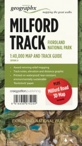
The Milford Track traverses an outstanding cross-section of the mountainous landforms which make up Fiordland National Park. Follow in the footsteps and marvel at the feats of early explorer Quintin Mackinnon, as you walk the length of this 53.5 km historic route.
Features:
- Scale: 1:40,000
- Milford Road 3D Map on reverse
- Track note, elevation and distance graphic
- Printed on waterproof, tear-resistant paper
- FOLDED MAPAvailable in a Matt lamination on requestSee other Track Maps in this series ie: Routeburn, Heaphy, Kepler, Milford

